WildWing
An open-source, autonomous and affordable UAS for animal behaviour video monitoring using Parrot Anafi drones to track group-living animals.
![]()
![]()
References
- Paper: WildWing: An open-source, autonomous and affordable UAS for animal behaviour video monitoring
- Dataset: WildWing deployment data
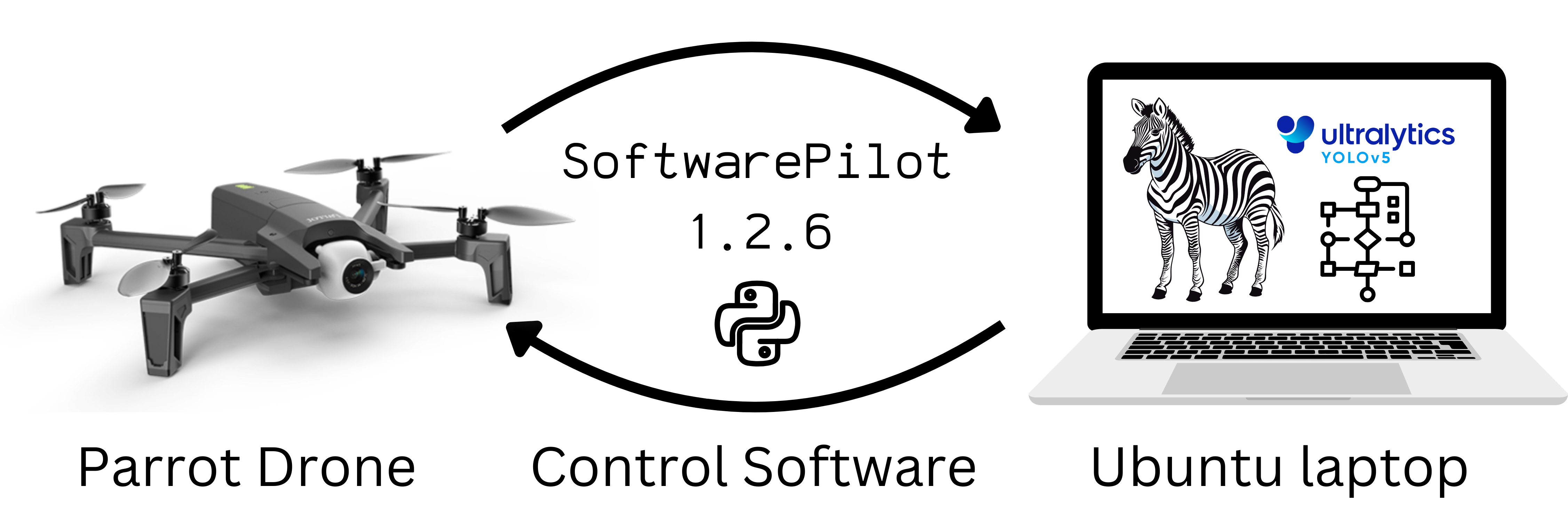
- Control Software: SoftwarePilot
- Video Analysis Tools: KABR tools for automatic behavior labeling
- Field Deployment Guide: WildWing wiki - Detailed instructions for in-field operations and deployment phases
- Key Terms:
- UAS: Unmanned Aerial System
- YOLO: Computer vision model for object detection
- Autonomous Navigation Policy: Algorithm that analyzes video frames and determines drone commands
Acknowledgements
This work was supported by the National Science Foundation (NSF) funded AI institute for Intelligent Cyberinfrastructure with Computational Learning in the Environment (ICICLE) under OAC #2112606.
This work was also supported by the Imageomics Institute, which is funded by the US National Science Foundation's Harnessing the Data Revolution (HDR) program under Award #2118240 (Imageomics: A New Frontier of Biological Information Powered by Knowledge-Guided Machine Learning).
The data was gathered at The Wilds, a private, non-profit conservation center located on nearly 10,000 acres of reclaimed coal mine land in southeastern Ohio, conducted under approval by the The Wilds Science Committee.
Issue reporting
Please report issues through GitHub issues in this repository. For additional support, refer to the WildWing wiki for troubleshooting guidance.